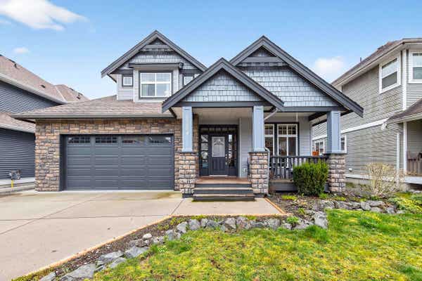
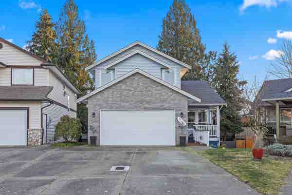
34045 HARTMAN AVENUE, MISSION, BC V2V 6B2
3
3
2,059 sq ft
Listed by Royal Lepage - Wolstencroft, Bob Mclean - Prec
Status: Active
MLS® #R3112812
Interested in this property?
We are here to help you in your home buying journey. Would you like us to send you more information about 34045 HARTMAN AVE, listed for $1,099,900?
Property description for 34045 Hartman Avenue, Mission, BC V2V 6B2
QUICK OVERVIEW
Built in 1947
$534 / Sq Ft
10 parking spaces
Baseboard, Forced Air, Natural Gas
1 Day on website
1.78 acres lot
INTERIOR
BUILDING AND CONSTRUCTION
EXTERIOR AND LOT
UTILITIES
AREA AND SCHOOLS
FINANCIAL INFO
ADDITIONAL INFO
Price per square foot and days on website are not provided values and are calculated by REMAX.
Listing Agent Bob Mclean - Prec
Listing Office Royal Lepage - Wolstencroft, 604-200-1444
Updated Sunday, April 19, 2026 at 3:48:34 AM
This representation is based in whole or in part on data generated by the Chilliwack & District Real Estate Board, Fraser Valley Real Estate Board or Greater Vancouver REALTORS® which assumes no responsibility for its accuracy. Copyright© 2026 Greater Vancouver REALTORS®. All Rights Reserved.
NEIGHBOURHOOD
CLIMATE RISK FOR V2V 6B2
Mortgage Payments for 34045 Hartman Avenue, Mission, BC V2V 6B2
$4,993
Monthly
Comparable listings to
34045 Hartman AVE, MISSION, BC V2V 6B2
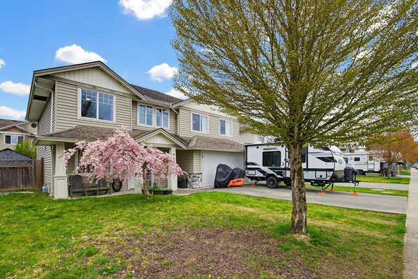
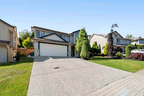
8784 NOTTMAN STREETMISSION, BC V2V 0C1
4
3
2,698 SQ FT
Listing by Royal Lepage - Wolstencroft
MLS® #: R3098583

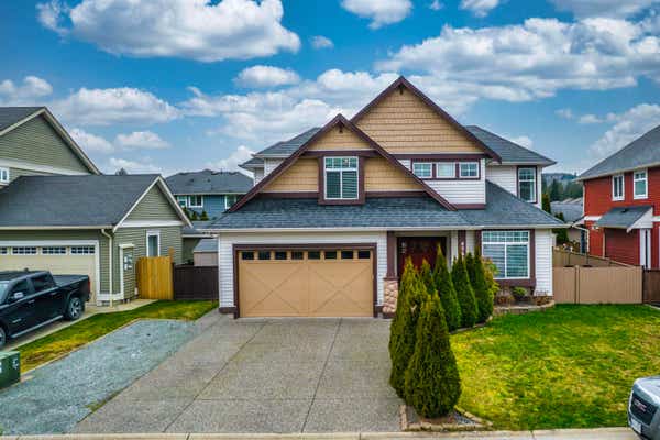
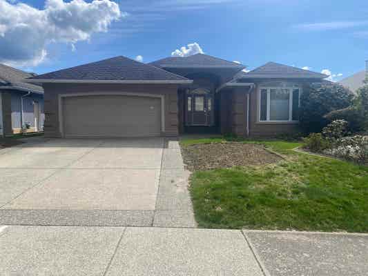
8627 HENDERSON STREETMISSION, BC V2V 7P9
4
3
2,337 SQ FT
Listing by Royal Lepage - Wolstencroft
MLS® #: R3111200
Visite Virtuelle
8761 MACHELL STREETMISSION, BC V4S 0B6
4
3
2,401 SQ FT
Listing by Royal Lepage Elite West
MLS® #: R3092984
Visite Virtuelle
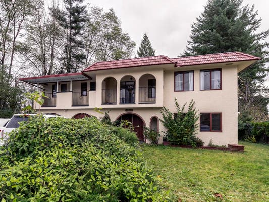
32976 HAWTHORNE AVENUEMISSION, BC V2V 7C3
4
4
2,050 SQ FT
Listing by Vybe Realty
MLS® #: R3111359
7923 TOPPER DRIVEMISSION, BC V2V 6Z2
4
3
2,368 SQ FT
Listing by Royal Lepage Little Oak Realty
MLS® #: R3080557
33508 12TH AVENUEMISSION, BC V2V 5Z6
4
3
3,512 SQ FT
Listing by Royal Lepage Little Oak Realty
MLS® #: R3105494
Visite Virtuelle
32389 CHICKADEE AVENUEMISSION, BC V2V 5A9
4
3
2,463 SQ FT
Listing by Top Producers Realty Ltd.
MLS® #: R2933403
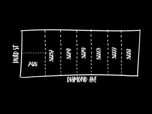
32237 DIAMOND AVENUEMISSION, BC V2V 1M3
4
2
1,846 SQ FT
Listing by Century 21 Coastal Realty Ltd.
MLS® #: R2962242
12297 ROACH STREETMISSION, BC V4S 1L4
3
2
2,188 SQ FT
Listing by Royal Lepage Brent Roberts Realty
MLS® #: R3109869

Get Real Estate Advice
Enter your email for REMAX's HomeHQ newsletter. Grab market updates, expert selling tips, and real estate advice.
By submitting your information, you are agreeing to the Privacy Notice and Terms of Use.
I agree to receive commercial electronic messages regarding news, updates, promotions, business opportunities and other related communications from RE/MAX*, its affiliates, and third parties designated by RE/MAX. I understand I may unsubscribe at any time.
*RE/MAX, LLC, 5075 S. Syracuse St., Denver CO, 80237 1-800-525-7452; REMAX Canada Inc., 639 Queen Street West, Toronto, ON M5V 2B7, 905-542-2400Voted the Most Trusted Agents in Real Estate*
FIND A REMAX AGENT