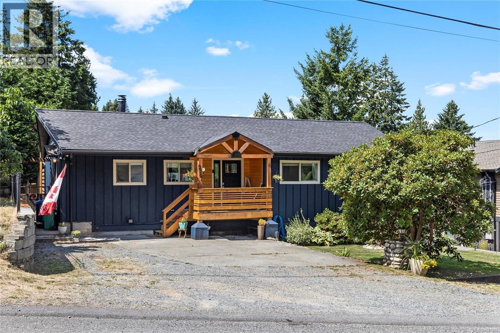
Contemporary, West Coast
2184 Sq M
Transit Nearby
Vinyl Siding
Split Level
Concrete Perimeter
Three Or More
Aquariums, Birds, Caged Mammals, Cats Ok, Dogs Ok
Resale
Single Family Residence
Residential
Asphalt
Aluminum Frames, Blinds, Insulated Windows, Screens
1987
West
Garden
Fenced
3
True
Corner Lot, Landscaped, Level
0.21
0.21 Sq M
9148
Acres
True
Additional Parking, Driveway, Garage
4
Paved
R5
Residential
Ceiling Fan(s)
True
True
Baseboard, Electric, Heat Pump
True
Sewer Connected
Natural Gas Available
Public
Nanaimo
Nanaimo
Nanaimo, City Of
V9T 5M6
Freehold
$5,458.43
790000
Lot 7, Plan Vip53561, District Lot 38, Wellington Land District
2025
1037590
MLS® property information is provided under copyright© by the Vancouver Island Real Estate Board and Victoria Real Estate Board. The information is from sources deemed reliable, but should not be relied upon without independent verification. https://reciprocity.vireb.com/
4
3
1,885 SQ FT
Listing by 460 Realty Inc. (na)
MLS® #: 1047551
3
3
2,540 SQ FT
Listing by Remax 2000 Realty - Alex Andjelkovic
MLS® #: 1046839
3
2
1,639 SQ FT
Listing by Royal Lepage Nanaimo Realty (nanishwyn)
MLS® #: 1047679
4
3
1,924 SQ FT
Listing by Remax Professionals - Ashley Metcalf
MLS® #: 1041570
3
3
2,487 SQ FT
Listing by Royal Lepage Island Living (pk)
MLS® #: 1048089
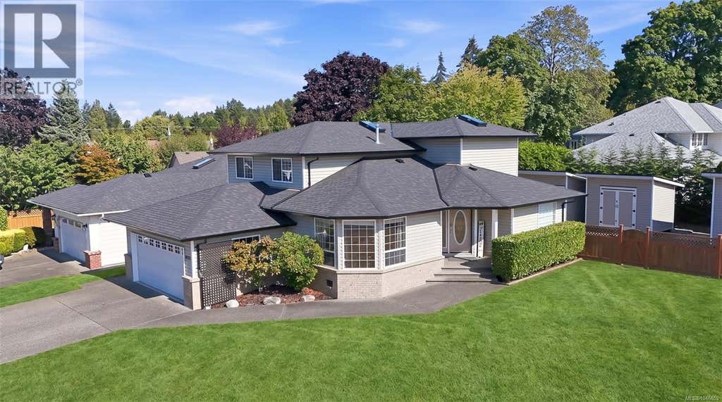
4
3
2,054 SQ FT
Listing by Remax Professionals - Jamie Odgers
MLS® #: 1046655
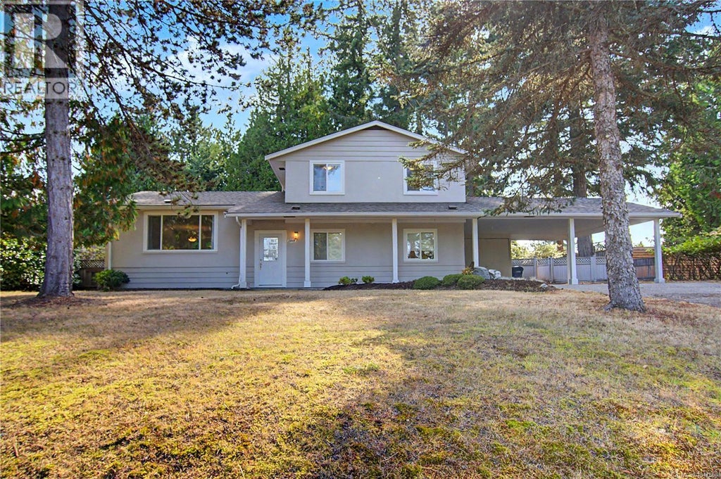
4
3
2,532 SQ FT
Listing by Remax Professionals - Marie Burrows
MLS® #: 1047860

4
3
2,779 SQ FT
Listing by Royal Lepage Nanaimo Realty (nanishwyn)
MLS® #: 1046538
Voted the Most Trusted Agents in Real Estate*
FIND A REMAX AGENT
Natural hazards vary by location and can change over time. The following provides a summary of potential impacts to this area, Postal Code V9T 5M6, over the next 30 years.
Flood - Lower Risk - Under 10% of buildings in this area have flood risk over the next 30 years.
Fire - Lower Risk - About 7 days in 2050 will have significant risk for fire spread, compared to 6 around 1990. Over 90% of buildings in this area have significant chance of wildfire.
Heat - Lower Risk - Around 1990, about 7 days per year reached above 29°C in this area. In 2050, about 19 days per year are projected to reach above 29°C.
Precipitation - Higher Risk - Around 1990, total annual rainfall was about 1827mm, and about 40% of rain fell in downpours with over 34mm in 2 days in this area. The projection for 2050 is about 1900mm of rain per year, with about 44% during these downpours.
Drought - Lower Risk - This location will likely have fewer dry months around 2050 than around 1990. The typical drought conditions will be less extreme around 2050.
Climate risk data is provided for informational purposes only. REMAX does not endorse nor guarantee this information. REMAX and its agents are not providing advice regarding climate risks. Consumers should independently investigate any property's climate risks as they deem appropriate.
Home buyers who prefer a relaxed atmosphere will enjoy Pleasant Valley-Rutherford. It is very easy to reach parks in the neighbourhood since there are over 50 of them close by for residents to check out. This part of the city is also reasonably good for those who need a quiet atmosphere, as the streets are generally quite calm - although that is not the case closer to the airport (Long Lake Water Aerodrome) or the railway line.
Learn more about Pleasant Valley-RutherfordExcellent access to freeways and/or major arteries, with almost no chance of parking problems
Exceptionally large amount of park space within a few minutes’ walk
At least one high school within a 15-minute walk
At least one daycare within a very short drive
Few sources of noise nearby
Excellent access to freeways and/or major arteries, with almost no chance of parking problems
Exceptionally large amount of park space within a few minutes’ walk
At least one high school within a 15-minute walk
At least one daycare within a very short drive
Few sources of noise nearby