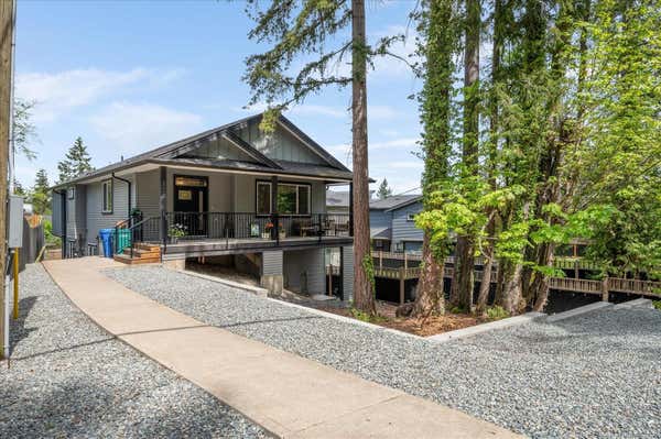
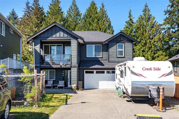
2374 MILL RD, NANAIMO, BC V9R 6S9
6
4
4,306 sq ft
Listed by Remax Professionals (na), Rick Horsland
rhorsland@remax.net, (250) 751-3533
Status: Active
MLS® #1034552
Property description for 2374 Mill Rd, Nanaimo, BC V9R 6S9
QUICK OVERVIEW
Built in 1975
$267 / Sq Ft
4 parking spaces
None
Baseboard, Electric, Forced Air, Natural Gas
1 Day on website
0.46 acres lot
INTERIOR
BUILDING AND CONSTRUCTION
EXTERIOR AND LOT
UTILITIES
AREA AND SCHOOLS
FINANCIAL INFO
ADDITIONAL INFO
Price per square foot and days on website are not provided values and are calculated by REMAX.
Listing Agent Rick Horsland
Listing Office Remax Professionals (na), 250-751-1223
Updated Tuesday, May 5, 2026 at 7:53:34 AM
MLS® property information is provided under copyright© by the Vancouver Island Real Estate Board and Victoria Real Estate Board. The information is from sources deemed reliable, but should not be relied upon without independent verification. https://reciprocity.vireb.com/
NEIGHBOURHOOD
CLIMATE RISK FOR V9R 6S9
Mortgage Payments for 2374 Mill Rd, Nanaimo, BC V9R 6S9
$5,220
Monthly
Comparable listings to
2374 Mill RD, NANAIMO, BC V9R 6S9
Visite Virtuelle
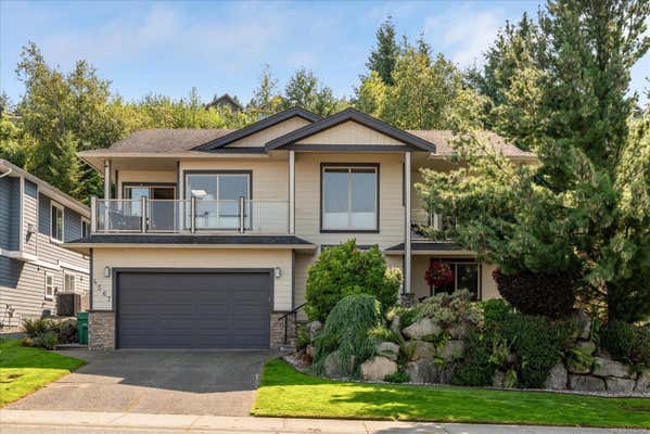
279 WESTWOOD RDNANAIMO, BC V9R 6S4
6
4
3,096 SQ FT
Listing by One Percent Realty Ltd.
MLS® #: 1034145
2314 ROCKWOOD PLNANAIMO, BC V9R 7B3
6
4
3,080 SQ FT
Listing by Royal Lepage Island Living (pk)
MLS® #: 1033907
Visite Virtuelle
628 ALYSSA PLNANAIMO, BC V9R 0H4
7
4
3,036 SQ FT
Listing by Sutton Group-west Coast Realty (nan)
MLS® #: 1014602
150 KIAN PLNANAIMO, BC V9T 0J7
6
3
2,688 SQ FT
Listing by Royal Lepage Nanaimo Realty (nanishwyn)
MLS® #: 1034526

Visite Virtuelle
4718 LAGUNA WAYNANAIMO, BC V9T 5C3
5
4
2,708 SQ FT
Listing by Sutton Group-west Coast Realty (nan)
MLS® #: 1031915
Visite Virtuelle
4567 SHERIDAN RIDGE RDNANAIMO, BC V9T 6S6
5
3
2,643 SQ FT
Listing by Royal Lepage Nanaimo Realty (nanishwyn)
MLS® #: 1032958
Visite Virtuelle
5560 RUTHERFORD RDNANAIMO, BC V9T 5M8
6
4
3,152 SQ FT
Listing by Re/max Professionals - Sean Mclintock
MLS® #: 1017357
Visite Virtuelle
5364 LAGUNA WAYNANAIMO, BC V9T 0B8
5
3
2,692 SQ FT
Listing by Century 21 Harbour Realty Ltd.
MLS® #: 1030863
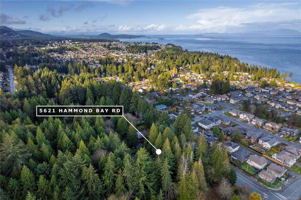
5621 HAMMOND BAY RDNANAIMO, BC V9T 5N2
5
3
2,600 SQ FT
Listing by Re/max Professionals - Jory Cole
MLS® #: 1020319

Get Real Estate Advice
Enter your email for REMAX's HomeHQ newsletter. Grab market updates, expert selling tips, and real estate advice.
By submitting your information, you are agreeing to the Privacy Notice and Terms of Use.
I agree to receive commercial electronic messages regarding news, updates, promotions, business opportunities and other related communications from RE/MAX*, its affiliates, and third parties designated by RE/MAX. I understand I may unsubscribe at any time.
*RE/MAX, LLC, 5075 S. Syracuse St., Denver CO, 80237 1-800-525-7452; REMAX Canada Inc., 639 Queen Street West, Toronto, ON M5V 2B7, 905-542-2400Voted the Most Trusted Agents in Real Estate*
FIND A REMAX AGENT