Comparable listings to
253 Chilton RD, SALT SPRING, BC V8K 2W9
Virtual Tour
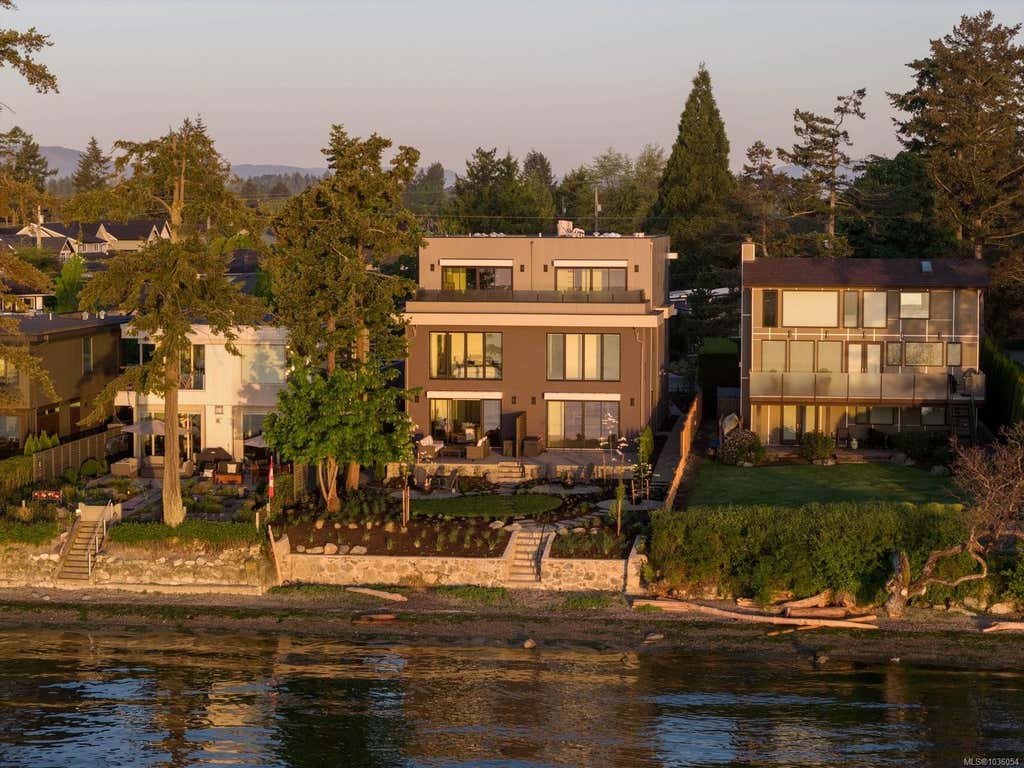
1-10393 ALLBAY RDSIDNEY, BC V8L 2N8
3
3
1,807 SQ FT
Listing by Macdonald Realty Ltd. (sid)
MLS® #: 1036054
3
3
23
Private Drive/road
244
Monthly
Ground Level Main Floor, Primary Bedroom on Main
Contemporary, West Coast
3414 Sq M
Wood Siding
Ground Level
Concrete Perimeter
32
Shed(s)
Aquariums, Birds, Caged Mammals, Cats Ok, Dogs Ok, Number Limit
Resale
Single Family Residence
Residential
Metal
Skylight(s), Wood Frames
2004
True
Northeast
Garden
2
True
Cul-de-sac, Irregular Lot, Private
7.39
7.39 Sq M
321908
Acres
True
Attached, Driveway
4
Paved
True
Mountain(s), Valley, Ocean
True
Uplands RU1
Rural
Ceiling Fan(s)
True
Fireplace Insert, Baseboard, Electric, Heat Pump, Wood
True
Septic Tank
Private
Salt Spring
Gulf Islands
Capital Regional District
V8K 2W9
Mt. Tuam
Freehold/strata
Private Maintained Road
$8,503.58
1916000
Strata Lot 8, Plan Vis5021, Section 38/42/43, Cowichan Land District, Portion Salt Spring Island, Together with An Interest in the Common Property in Proportion to the Unit Entitlement of the Strata Lot As Shown on Form 1 Or V, As Appropriate
2025
1039762
MLS® property information is provided under copyright© by the Vancouver Island Real Estate Board and Victoria Real Estate Board. The information is from sources deemed reliable, but should not be relied upon without independent verification. https://reciprocity.vireb.com/
3
3
1,807 SQ FT
Listing by Macdonald Realty Ltd. (sid)
MLS® #: 1036054
Voted the Most Trusted Agents in Real Estate*
FIND A REMAX AGENT
Natural hazards vary by location and can change over time. The following provides a summary of potential impacts to this area, Postal Code V8K 2W9, over the next 30 years.
Flood - Lower Risk - Under 10% of buildings in this area have flood risk over the next 30 years.
Fire - Lower Risk - About 7 days in 2050 will have significant risk for fire spread, compared to 7 around 1990. About 72% of buildings in this area have significant chance of wildfire.
Heat - Lower Risk - Around 1990, about 7 days per year reached above 29°C in this area. In 2050, about 22 days per year are projected to reach above 29°C.
Precipitation - Higher Risk - Around 1990, total annual rainfall was about 1186mm, and about 41% of rain fell in downpours with over 25mm in 2 days in this area. The projection for 2050 is about 1240mm of rain per year, with about 45% during these downpours.
Drought - Lower Risk - This location will likely have fewer dry months around 2050 than around 1990. The typical drought conditions will be less extreme around 2050.
Powered by Local Logic.

Climate risk data is provided for informational purposes only. REMAX does not endorse nor guarantee this information. REMAX and its agents are not providing advice regarding climate risks. Consumers should independently investigate any property's climate risks as they deem appropriate.
La tranquillité est un élément important du caractère de Saltspring Island. Le district régional électoral est extrêmement paisible, puisque la pollution sonore liée à la circulation des véhicules pose rarement problème.
Learn more about Saltspring IslandAccès exceptionnel à des voies rapides et/ou des artères majeures, avec un risque quasi nul de problèmes de stationnement
Pas ou très peu de sources de bruit à proximité
Peu adapté pour les déplacements à vélo et/ou pour le cyclisme récréatif
Quelques restaurants à quelques minutes en voiture
Peu ou pas d'épiceries à quelques minutes en voiture
Accès exceptionnel à des voies rapides et/ou des artères majeures, avec un risque quasi nul de problèmes de stationnement
Pas ou très peu de sources de bruit à proximité
Peu adapté pour les déplacements à vélo et/ou pour le cyclisme récréatif
Quelques restaurants à quelques minutes en voiture
Peu ou pas d'épiceries à quelques minutes en voiture