25 Maclean Rd, Victoria, NS B1X 1L2
Speak to your neighborhood REMAX agent to get a free home value estimate.
Property description for 25 Maclean Rd, Victoria, NS B1X 1L2
NEIGHBOURHOOD
CLIMATE RISK FOR B1X 1L2
Comparable listings to
25 Maclean RD, VICTORIA, NS B1X 1L2
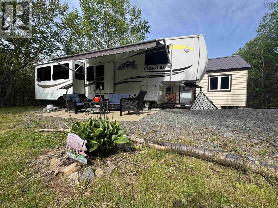
15 BAYVIEW LANEVICTORIA, NS B0E 1B0
1
1
400 SQ FT
Listing by Remax Park Place Inc - Jenessa Macinnis
MLS® #: 202615112

Get Real Estate Advice
Enter your email for REMAX's HomeHQ newsletter. Grab market updates, expert selling tips, and real estate advice.
By submitting your information, you are agreeing to the Privacy Notice and Terms of Use.
I agree to receive commercial electronic messages regarding news, updates, promotions, business opportunities and other related communications from RE/MAX*, its affiliates, and third parties designated by RE/MAX. I understand I may unsubscribe at any time.
*RE/MAX, LLC, 5075 S. Syracuse St., Denver CO, 80237 1-800-525-7452; REMAX Canada Inc., 639 Queen Street West, Toronto, ON M5V 2B7, 905-542-2400Voted the Most Trusted Agents in Real Estate*
FIND A REMAX AGENT